
Formally known as Taroko National Park (太魯閣國家公園), this 19-km-long canyon wrinkles the northeastern coast of Taiwan. The rough diamond of Hualien County, it is located southeast of Taipei and is accessible by a two-hour train ride. It is one of the eight national parks in Taiwan. First established as the Tsugitaka-Taroko National Park in 1937 under the Empire of Japan, it was abolished in 1945 and was reestablished on November 28, 1986.


Manmade structures have also sprouted in key spots, providing rest stops and religious oases to tourists and locals. But it is its sheer natural charm that draws the crowds from all over the world. Sharp crags tower over valleys of subtropical forests, which shelters 144 species of birds, 251 butterflies, 32 reptiles, and 30 species of large mammals.
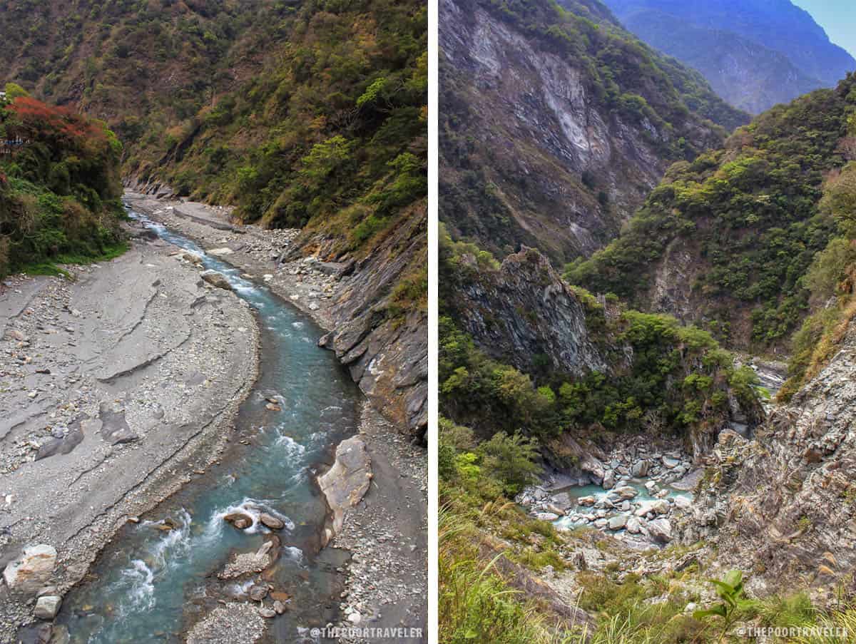
The area is famous for its marbles, a product of the tectonic skirmish between the Eurasian and Philippine plates. The limestone metamorphosed into marble as the battling plates forced the site to rise over 100 million years. It continues to grow 0.5 cm per year.
Here are eight scenic spots you just can’t miss should you find yourself in this extraordinary destination.
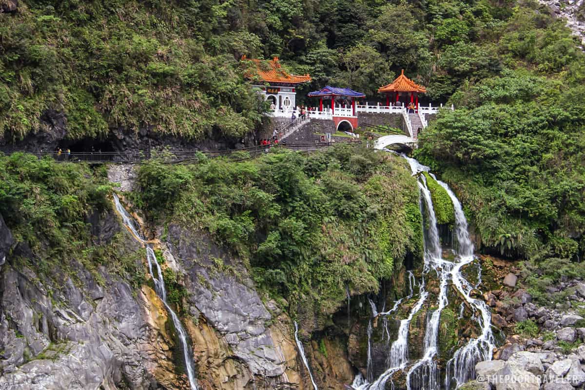
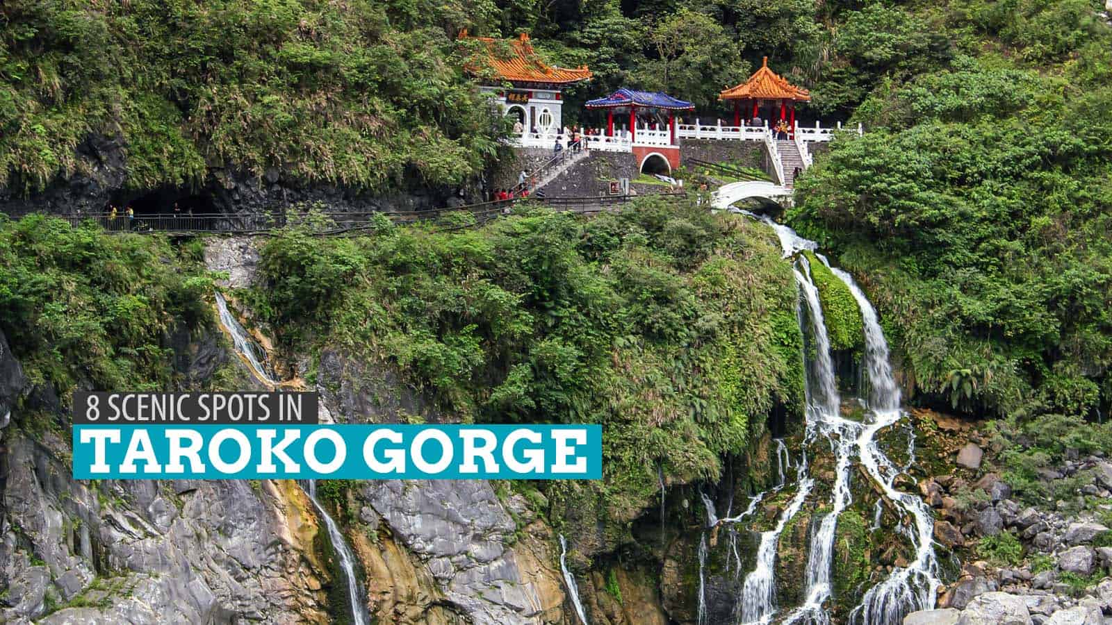
Changchun Shrine (Eternal Spring Shrine)
The Changchun Shrine is the most iconic sight in all of Taroko Gorge. Spring water gushes through the shrine and down a cliff, forming a spectacular waterfall. The structure stands elegantly on top of the cascade, as if providing life to the arid land below. Built in honor of the 226 military veterans who lost their lives during the construction of the Central Cross-Island Highway, the Changchun Shrine is a peaceful sanctuary in the middle of the fast rising tourist destination.
Shakadang Trail
The bus passed through a tunnel and made a stop after a 94-m bridge. Shakadang Bridge is guarded by 100 stone lions that sit comfortably on its edges. We straddled the bridge and climbed down a staircase to the start of the Shakadang Trail. Often called the Mysterious Valley Trail, this 4.5km path is etched on a cliffside beside a shallow, rocky stream. We followed the trail and feasted our eyes with the countless rock folds along the way. Tung trees adorn both sides of the stream, and in May decorate the trail with flowers.
Jiuqudong (Tunnel of Nine Turns)
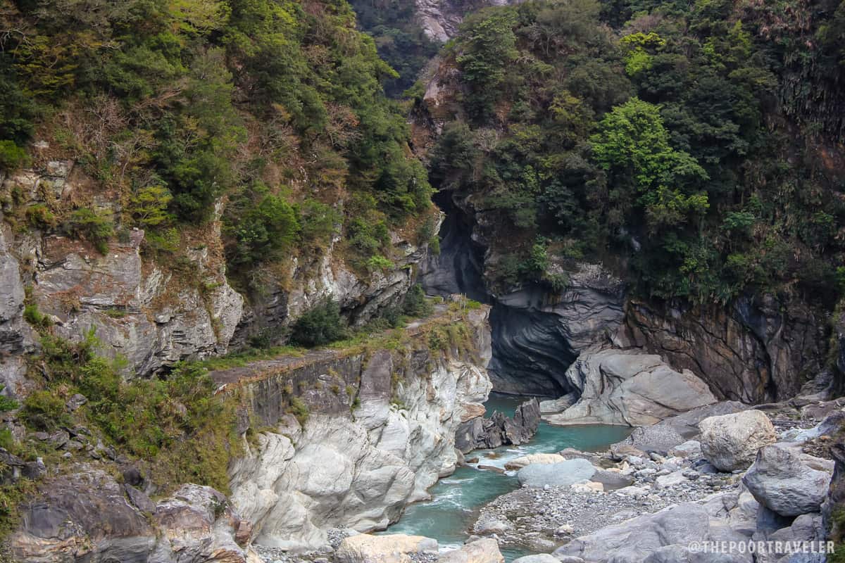
Widely regarded as the most marvelous spot in Taroko Gorge, the Tunnel of Nine Turns is where the cliffs get dangerously close to each other. Dangerous may not be as applicable now, but it clearly was the case during the initial exploration of the canyon. Today, these marble cliffs stand so close to each other, as though they are about to kiss. Keeping them apart is a narrow 10-meter gap, the valley of the Kelan River, which shrinks as the peaks shoot skyward.
Yanzikou Trail (Swallow Grotto)
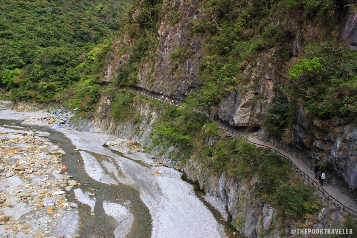
The Liwu River pushes itself across Taroko Gorge and cuts through the already rugged landscape. One of its marvelous creations is Yanzikou, a 1.4km walking trail in the park. Yanzikou means Swallow Grotto, so called for the countless Pacific Swallows and House Swifts that have nested at the site. Visitors tackling the crevices are treated to closer looks at the spring-showered cliff sides and some curious rock formations including the “Chieftain’s profile rock.”

Lushui Trail
Once the home to the Taroko settlement known as “Tuoyou’en,” the Lushui trail allows visitors to “follow in the footprints of earlier people.” The trail overlooks the Liwu River valley and gives an opportunity to see many of the site’s historical monuments.
Tianxiang
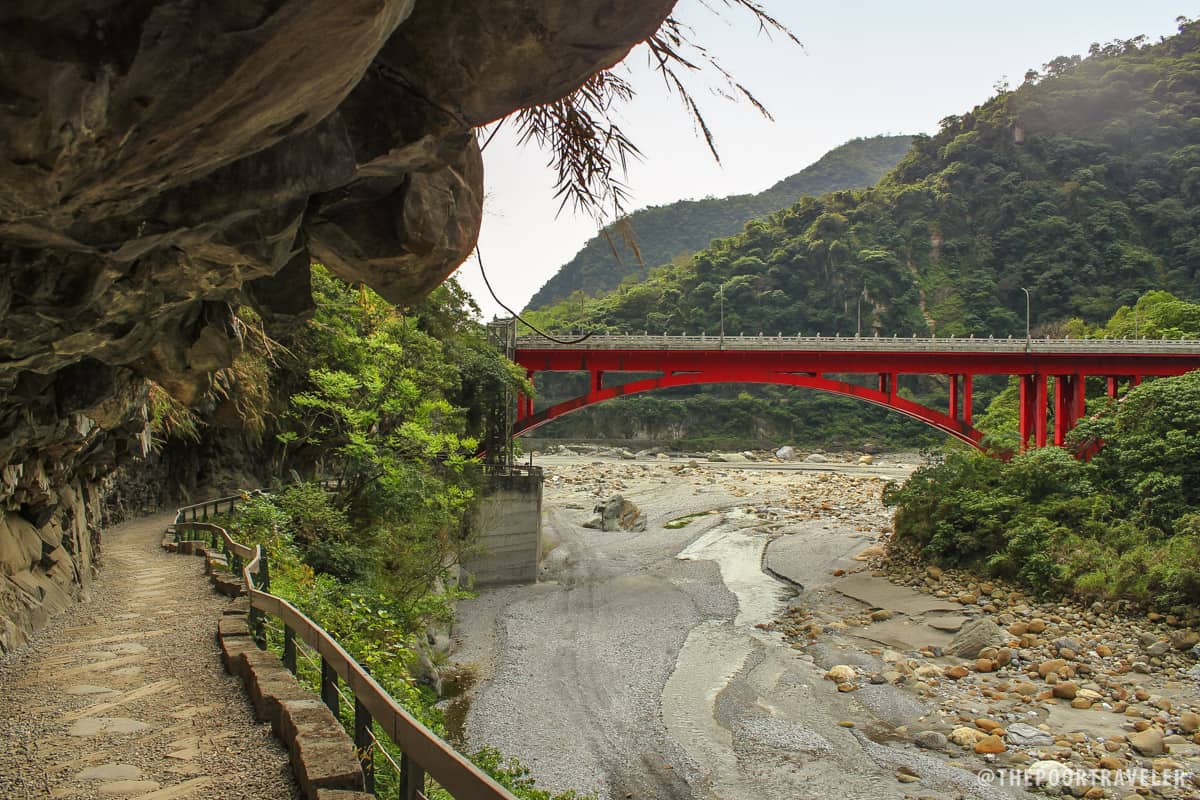
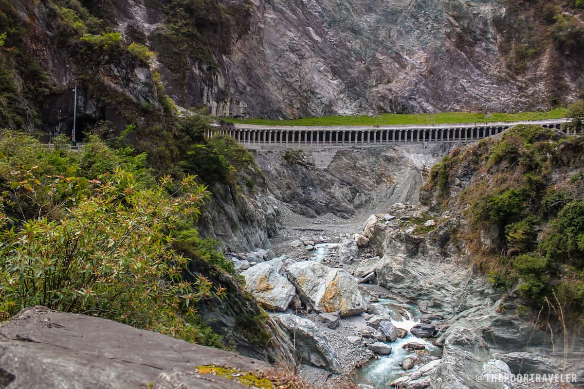
A usual “lunch stop,” Tianxiang is a river terrace recreational area and is one of the more developed areas in the park. Set at the confluence of the tributaries to Liwu River, the Taci Jili and the Dasha. It is surrounded by wondrously challenging topography — mountaintops and river dales, tunnels and bridges.
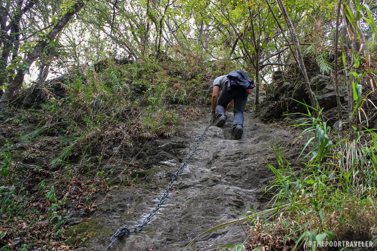
The Tiansiang-Baiyang Trail 2.1 km around the Sibao Mountain. It is a difficult trail. I did not know this when I began. Dressed in tight jeans and equipped with nothing but a shoulder bag (seriously), I only realized how tough the trail was when I was already half-way. At one point, the trail got too steep and the cliffs sharp that I just found myself rappelling (sort of, there was a chain on the spot, but there was no one else).
“The area used to be known as ‘Tapido’ from the local Taroko word for sugar palm which was prevalent in the area,” a route marker explains. “The area was settled over 190 years ago and is one of the early Taroko communities in what is now bounded by the National Park…. In 1914 the Japanese invaded and occupied the area that we now know as Tiansiang. They set up administrative offices and forced the Taroko people to the smaller area across the Liwu River.” The remains of the Tapido settlement are what await brave hikers here. And a fantastic vista of the so-called “Entrenched Meander.”
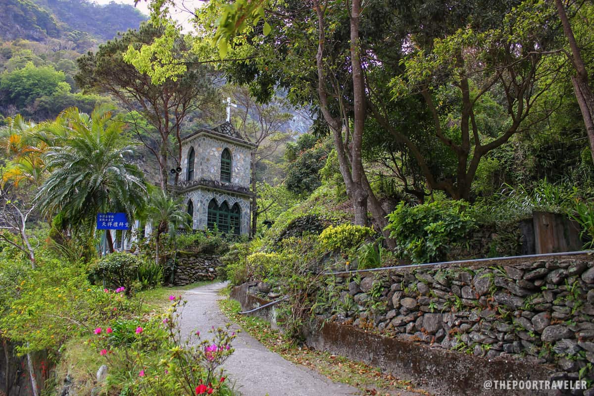
On the southeast terrace of the Sibao Mountain at 453m lies the Tian Xiang Park, a perfect place to catch panoramic views of the region, and a Catholic church. The trail ends (or starts) here.
Xiangde Temple
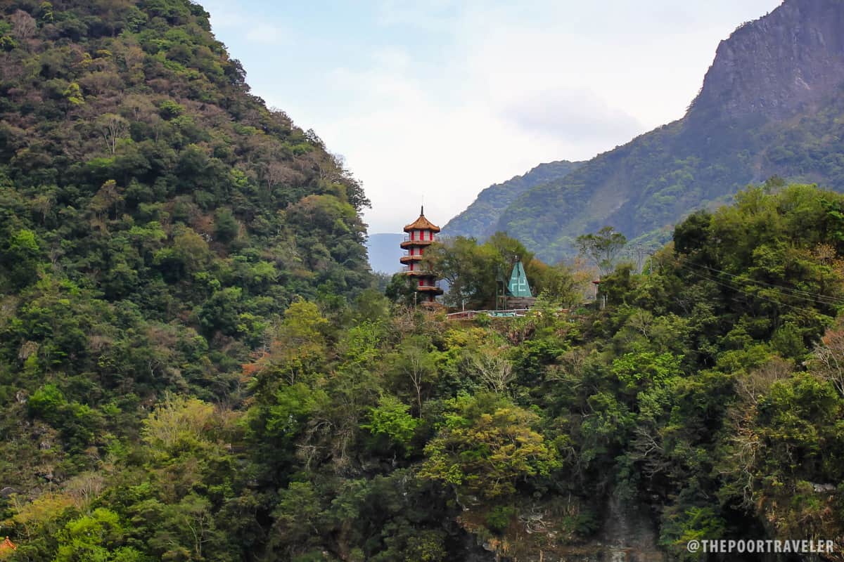
On the northwest plateau of the opposite Jiangkou Mountain at 457m stands the Xiangde Temple, the centerpiece of a Buddhist Linzizong complex. It was completed in 1968, after the opening of the Central Cross-Island Highway. The other structures in the area include the 7-story Tian Feng Pagoda and the Giant Statue of Guan Yin, a Bodhisattva and Goddess of Mercy.
Qingshui Cliff
Unlike most of the viewing spots in Taroko Gorge, the Qingshui Cliff do NOT offer breathtaking views of the Liwu River Valley. Instead, it faces the mighty Pacific! Located along the Su-Hua Highway at an elevation 800 meters, the 21km Qingshui Cliff skirts the gneiss and marble mountainside by the sea. This coastal road makes every drive scenic and every stop inspiring.
From here, it is not difficult at all to realize the hardship of those who built this road and all the others that meander across the national park.
From here, it is not difficult at all to see why a long time ago, a Truku tribesman who was lost in a marvelous marble maze came out of it and shouted, “Taroko!” You would probably do the same.
How to get to Taroko Gorge: From Taipei, take the train to Hualien City (2 hours). From the Hualien Train Station, walk to the bus. It’s the bright orange building adjacent the train station. Purchase a full-day bus pass, which includes unlimited bus rides to and around the national park. Price is NTD 170 (around PHP 250).


Are permits needed for some of the trails?